Well hurricane season has definitely started. The first named store Ana is on the way here; she will be coming through early Monday morning. Then the second storm, currently Tropical Depression 3, but will be named Bill by later today, will be coming through on Thursday. Both storms are tracked to go right through here, but hopefully they will either fizzle out or turn north, keep your fingers crossed. Last year we didn't have a close call until October, so I hope this is not a sign of things to come.
Jay took off for Puerto Rico this afternoon with a group of CYOA boats and won't be back until Sunday morning. The boats were scheduled to go on Monday, but with the news of the storms, it was decided to play it safe and take them today. A bunch of our boating friends are taking off in the morning to take their boats to Vieques (small island of Puerto Rico) to a hurricane hole to ride out both storms. I wish them safe travels and a safe return.
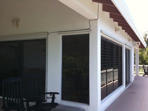
As soon as Jay gets back tomorrow we will start putting up the hurricane shutters at the house. This is a different house than last year so it will be a little bit of a different experience. The shutters at the new place are aluminum panels that have to be put up one at a time, each panel overlapping the next. As you can see from the above pic, we have lots of windows (and three sets of sliders) across the back of the house so it will take a little bit of time to put them all up. The side windows have accordion style shutters that should be easy to put in place. The neighbors down stairs have been through this several times so they will be able to provide assistance, thank goodness. Jay has put up these kind of shutters before but it will be a first for me, so this should be interesting.
We'll keep you posted of the situation over the next several days. Think happy thoughts and hopefully it's all hype and nothing will come of it.
National Weather Service -
... TROPICAL STORM ANA MAY IMPACT LOCAL ISLANDS BY MONDAY EVENING...
.SITUATION OVERVIEW... AT THE PRESENT MOMENT... TROPICAL STORM ANA IS NOT WELL ORGANIZED BUT THE FORECAST IS FOR THE STORM TO SLOWLY INTENSIFY DURING THE NEXT TWO DAYS AS IT MOVES TOWARDS THE ISLANDS OF THE NORTHEAST CARIBBEAN. AT THIS TIME... IT IS TOO EARLY TO PROVIDE EXACT WIND... RAINFALL... AND SURGE FORECAST VALUES FOR SPECIFIC LOCATIONS. A GENERAL CONCERN SHOULD BE FOR THE POSSIBILITY OF AT LEAST DAMAGING WINDS AND LOCALIZED FLOODING SOMEWHERE WITHIN PUERTO RICO AND THE U.S. VIRGIN ISLANDS.
No comments:
Post a Comment